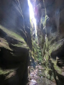
Looking up Mickey's Creek Gorge at Carnarvon Gorge N.P.
The rain stopped just long enough for a look out at the spot where Captain Cook shipwrecked. Another storm is building, no wonder he had a hard time navigating.
Destination Cooktown, the first leg of our trip, from Melbourne it was 9000 km through what seemed like a hundreds National Parks, along seasides and over mountains. If you look at a map of the country you can see that 90 percent of Australia lives of the east coast, there are many, many twisty roads from the small towns like Alice Waters to the large cities like Sydney. The number of different types of birds here is astronomical. Every time I hand the camera over to Ken he come back with a few more pictures of our fine feathered friends.
Leaving Melbourne one of the first things we noticed were the great number of forrest fires that had devastated the forestry reserves and National Parks. We spent one whole day winding our way through what must have been a beautiful park at one time but now, recently burned, all that was left was charred timber. Thankfully, the devastation didn't reach the Snowy Mountains and Mt. Kosciuszko, the highest mountain in Australia.
As usual we are trying to avoid large cities but we felt we had to visit Canberra, the Aussie capital and Sydney, just because it had to be done. Canberra was fascinating just because of the fact that it is a planned city with three distinct circular areas with roads and rivers joining them together. Sydney...what can I say! The Harbour Bridge (that we walked across), the Opera House and the walk through the Royal Botanic Gardens to funky Kings Cross, it was a long walking day. While in Sydney we stayed in the suburb of North Ryde, at a campsite which was very conveniently located 250 mts from the rapid transit and sat beside a cemetery so the neighbours were very quiet. A day ticket on the transit included a ferry ride to Manly on which we got a better view of all the sites than on an expensive tour.
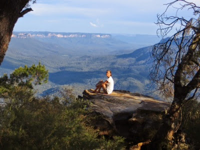
Winding back inland we drove through the Blue Mountains, the blue haze over the mountains in the morning is said to be due to a vapour off the Eucalyptus trees. A big highlight for us was the Wentworth Falls and the National Pass hike, we rated the hike #1 of all our hikes in N.Z. and Australia so far. The trail we walked was only about 8 km, but unbelievable! Staying inland we skirted the Hunter Valley, with all its very touristy wineries, on the Putty Rd then headed back to the coast.
Believe it or not White Lightning came with a buggy board so back at the coast we checked out Byron Bay (too touristy for us) and Port Macquarie and tried our hand at skimming the waves and swimming in the warm South Pacific Ocean. We didn't try our hand at surfing but we could buggie with the best of them!
Back inland we went around Brisbane, not wanting to drive through the city, even with a GPS we prefer the countryside. We were glad we did because we found another great park and hike at Mt. Warning. The hike was through the forrest with a scramble up the cliff for the last 300 mts or so only to find that the fog was so thick at the top we couldn't see two feet in front of our faces.
Did I mention that we zigzagged our way up the East Coast?
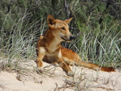
Back to the coast after Mt. Warning we landed on Fraser Island, the worlds biggest sand island, and actually took a tour. A big 4x4 picked us up early in the morning, showed us all the sites (fresh water lakes and dingos) on Fraser Island including lunch and high tea with wine and beer and dropped us off with a smile on our face. A great day, we may have to do a few more of those.
While we had been making our way here and there Cyclone Ida was making her way down in the direction of the Cape York Peninsula, Cooktown, wouldn't you know it...at the exact time we wanted to be there it was forecasted to hit at a category 4 to 5. We decided to wait out the storm farther south, we had a little time, at the Carnarvon N.P. and at Bundoora Dam. We did a 20 km hike up the gorge in Carnarvon checking out the the aboriginal paintings and just enjoying the exercise after too long sitting on our butts. Bundoora dam was good for swimming but a little busy because it was Easter Weekend, so that was to be expected.
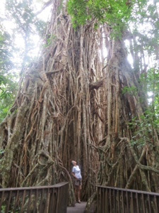
Cyclone Ida hit the north and did a little damage but we were on our way again headed for Cooktown via Innisfail and then inland through the Atherton Tablelands. We loved the Tablelands with an elevation of about 1000 mt or so it was a little cooler and we were able to sleep a bit better at night, not to mention it was very picturesque with all the rolling hills and farmland, and all the small waterfalls.
We made it all the way to Cooktown, as far as the pavement would take us and it was raining so hard we literally turned around and drove back 260 km in the direction we came, on the way to Daintree N.P. Oh yeh, which is in the middle of a rainforest that gets approximately 4 mts of rain a year. Guess what...it was raining when we got there and it rained all the night...about 12 cm! It was time for us to leave the coast and head for drier but maybe hotter and more humid territory. The Savannah Gulf and the Queensland Outback. Unfortunately that meant no Cairns and The Great Barrier Reef but the water was so murky from all Cyclone winds and all the rain that visibility was poor and everyone said not to waste our time. I guess it's a reason to come back.


